What is a Borehole?
About Boreholes
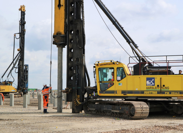
A borehole is a hole drilled or bored into soil or rock to investigate conditions below ground or carry out construction work. Its depth, diameter and direction depend on its purpose. Boreholes may be vertical, inclined or horizontal.
In ground engineering, boreholes provide access for sampling, testing, monitoring and ground treatment. Some are used to investigate ground conditions, while others are formed for construction applications such as bored piles, ground anchors or soil nails.
Where Boreholes Support Construction
Residential, commercial and institutional developments use investigation boreholes to inform the design of foundations, basements and earthworks. Infrastructure and rail projects require subsurface information for bridges, transport routes, cuttings and retaining walls.
Marine investigations examine ground beneath proposed quays, jetties and harbour works. Energy projects may use borehole investigations to assess ground conditions for substations, generating facilities and wind turbine foundations.
During construction, drilling can serve a different purpose. Boreholes may be formed to install reinforcement and concrete for bored piles, tendons for ground anchors or grout for ground treatment. These construction boreholes are formed according to the requirements of the installation rather than an exploratory sampling programme.
What Can a Borehole Tell Engineers?
A ground investigation borehole allows engineers to examine material that cannot be assessed from the surface. Samples, recovered rock core and in-situ tests help establish the ground profile.
Depending on the investigation, information can include:
- Soil and rock layers: their composition, thickness and the depths at which changes occur.
- Engineering properties: evidence used to assess strength, compressibility and likely foundation behaviour.
- Groundwater: water strikes during drilling and levels recorded through subsequent monitoring.
- Made ground and obstructions: indications of buried construction materials, disturbed deposits or hard layers.
- Potential contamination: soil or water samples submitted for appropriate laboratory analysis.
- Voids and historical workings: evidence that may justify further investigation or targeted treatment.
Not every borehole provides all this information. The sampling programme and selected tests must match the questions the investigation needs to answer.
Choosing Borehole Positions and Depths
Locations are planned based on the proposed development, site history and available geological information. Investigation points may target heavily loaded areas, changes in ground level or suspected hazards rather than follow a uniform spacing.
The required depth depends on the ground zone that could influence the works. Finding a strong layer does not always justify stopping, particularly if weaker deposits beneath it could affect foundation performance.
Access, buried services and nearby structures also influence positioning. Where constraints prevent drilling at an intended location, engineers must consider how this affects the coverage of the investigation.
Ground Investigation Borehole Drilling Methods
The drilling method must suit the expected ground conditions, required depth and type of evidence being collected. Common approaches include:
- Cable percussion drilling: uses tools suspended from a cable to advance through suitable soils. Temporary casing can support unstable material while samples and in-situ tests, such as Standard Penetration Tests (SPTs), are carried out at selected depths.
- Rotary coring: uses a rotating core barrel to recover cylindrical samples, allowing engineers to examine rock composition, fractures and condition.
- Rotary open-hole drilling: advances using a cutting tool and returns cuttings to the surface. It can help establish changes in ground conditions or investigate suspected workings, although it does not preserve an intact core.
- Window sampling: uses driven sampling tubes to recover soil, often with compact equipment suited to shallower investigations or restricted-access locations.
A combination of techniques may be needed where superficial soils overlie rock. Borehole support and drilling fluids must also be selected carefully so that the work does not unnecessarily compromise samples or measurements.
Reading Borehole Records in Context
A borehole log records the sequence of ground encountered at a particular location. It typically identifies the borehole position, drilling method, strata descriptions, sample depths, test results and relevant observations.
The log provides evidence, but interpretation requires wider context. Ground conditions can change between investigation points, and a single borehole cannot establish conditions across an entire site.
Groundwater observations also require careful interpretation. A level measured during drilling may be affected by the drilling method or may not have stabilised. Monitoring over time can provide a more useful picture of groundwater behaviour.
Engineers combine borehole records with laboratory results, other field investigations and geological understanding to develop a ground model for design.
Borehole Completion and Sealing
An investigation borehole may be fitted with equipment for groundwater, ground gas or movement monitoring. Its completion details must suit the measurements required and prevent unwanted connections between different ground layers.
Where no monitoring installation is required, the borehole is backfilled or sealed appropriately and the surface reinstated. Monitoring installations also require proper closure when their purpose ends.
The lasting value of an exploratory borehole lies in the evidence it provides. Accurate records, appropriate testing and careful interpretation help engineers use that evidence to understand ground conditions across the wider project.

Written by Aarsleff UK
22 October 2026
Aarsleff Ground Engineering is a leading sheet piling supplier and contractor. We specialise in designing and delivering sheet piling solutions across the UK.

Reviewed by Mark Fuller, Piling Director
7 October 2026
Mark Fuller is the Piling Director at Aarsleff Ground Engineering. He has amassed a wealth of experience and knowledge within the specialist piling and ground engineering industry throughout his 20 years of experience in the industry. Mark is directly responsible for the overall driven piling within the business, including technical and operational management of awarded contracts, development of strategic long-term plans and planning of recruitment and resource.
Close