What Is a Hydrographic Survey?
Table of Contents
- Definition and Purpose of Hydrographic Surveys
- Survey Methods Used in Marine Projects
- What Are the Applications of Hydrographic Surveys?
- Role Within Ground Engineering Projects
- What Equipment Is Used During Survey Operations?
- Survey Data Processing and Interpretation
- Importance of Hydrographic Surveys in Construction
Last updated
12 August 2026
Definition and Purpose of Hydrographic Surveys
A hydrographic survey measures and maps underwater environments to assess seabed conditions, water depth, submerged features, and navigational characteristics. These surveys support marine construction, infrastructure planning, dredging operations, and offshore engineering activities.
Within ground engineering and marine development projects, hydrographic data assists with design coordination, risk assessment, and construction sequencing. Survey information may also support piling operations, retaining walls near waterfront structures, and underwater foundation planning.
Survey outputs are typically used to identify changes in seabed profile, locate obstructions, and establish accurate underwater positioning data before construction begins.
Survey Methods Used in Marine Projects
Several methods of hydrographic surveying are used depending on water depth, project scale, environmental conditions, and required accuracy.
Echo Sounding Survey Techniques
Echo-sounding equipment forms a central part of many hydrographic operations. Sound waves are transmitted toward the seabed surfaces before the reflected signals return to the survey instruments. Water depth calculations are then produced using sound travel time measurements.
Single-beam and multibeam systems may both be used depending on coverage requirements and survey resolution.
Side Scan Sonar Operations
Side scan sonar systems generate detailed seabed imagery by transmitting acoustic signals across underwater surfaces. These surveys assist with identifying debris, obstructions, seabed irregularities, and submerged structures.
Marine infrastructure schemes often rely on sonar data during route planning and installation assessment.
Positioning and GPS Integration
Hydrographic surveys commonly integrate satellite positioning systems to maintain accurate location tracking throughout data collection activities. Positioning accuracy remains particularly important during offshore construction and marine piling operations.
What Are the Applications of Hydrographic Surveys?
Hydrographic surveys support multiple construction and infrastructure sectors where underwater conditions influence engineering design or construction safety.
Typical applications include:
- Port and harbour developments
- Offshore energy projects
- Bridge and marine structure construction
- Dredging operations
- Coastal defence schemes
- Underwater pipeline installation
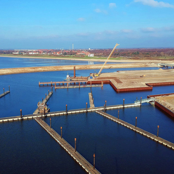
In waterfront developments, survey information may assist with retaining walls, quay structures, and marine foundation arrangements where seabed stability affects long-term structural performance.
Hydrographic data can also support feasibility assessment before piling installation in tidal or submerged environments.
Role Within Ground Engineering Projects
Hydrographic surveying forms part of wider site investigation procedures on marine and coastal developments. Combined geotechnical and hydrographic information provides engineers with a more complete understanding of underwater ground conditions.
This approach supports planning for:
- Marine piling systems
- Subsea excavation works
- Cofferdam installation
- Foundation design near watercourses
- Sediment movement assessment
When underwater structures interact with changing seabed conditions, accurate survey data supports structural planning and construction coordination.
Ground engineering assessments may also incorporate borehole data, sediment sampling, and underwater profiling alongside hydrographic survey results.
What Equipment Is Used During Survey Operations?
Hydrographic survey vessels are fitted with specialised instruments designed to collect underwater positional and depth information under varying environmental conditions.
Equipment commonly includes:
- Echo-sounding equipment
- GPS positioning systems
- Motion reference units
- Sonar imaging systems
- Tide monitoring instruments
- Data processing software
A hydrographic survey engineer oversees equipment calibration, positional control, survey accuracy, and data interpretation throughout project operations.
Environmental conditions such as wave movement, tidal variation, and current flow may influence survey methodology during offshore and coastal works.
Survey Data Processing and Interpretation
Raw survey information undergoes processing before final outputs are produced for engineering and construction teams. Data correction procedures may account for tidal variation, vessel movement, signal interference, and positional adjustment.
Processed survey information can then be presented through:
- Seabed contour models
- Bathymetric charts
- Digital terrain mapping
- Submerged obstruction records
- Structural positioning layouts
Engineering teams use these outputs during planning, construction sequencing, and operational risk assessment.
Accurate interpretation remains essential where underwater conditions affect foundation performance or structural positioning.
Importance of Hydrographic Surveys in Construction
Hydrographic surveys continue to support marine engineering and infrastructure development across a wide range of environments. Their role in ground engineering projects extends beyond navigation, providing essential seabed information for structural planning, marine piling operations, retaining walls, and underwater construction.
As offshore development and waterfront infrastructure projects continue to expand, hydrographic surveying remains an important part of site investigation and marine construction planning.

Written by Aarsleff UK
12 August 2026
Aarsleff Ground Engineering is a leading sheet piling supplier and contractor. We specialise in designing and delivering sheet piling solutions across the UK.

Reviewed by Mark Fuller, Piling Director
14 May 2026
Mark Fuller is the Piling Director at Aarsleff Ground Engineering. He has amassed a wealth of experience and knowledge within the specialist piling and ground engineering industry throughout his 20 years of experience in the industry. Mark is directly responsible for the overall driven piling within the business, including technical and operational management of awarded contracts, development of strategic long-term plans and planning of recruitment and resource.
Close